This is a challenge to mnemonics lovers, how do you memorize the world countries map? And below is my prototype, I had memorized the Asian, South America and Oceania map. If you have any bright ideas, welcome and share.
Option #1: Play Plague.inc
Option #2: Use the world map as a memory palace and reference each country based on indirect imagery. I.e: The Canadian Moose is sitting on top of an American Eagle, sitting on top of a piñata, with Fidel Castro kicking it from behind, …
Option #3: If you cannot name something associated with a country, just create an image representing the country. I.e: Brazil = Godzilla with a bra, standing beside bOlivia who is Perl clutching on her left hand, and kicking a bowl of chili on her left leg. You get the idea…
Similar , like me too (I guess most of the people using this)
Well, I didn’t memorize all countries by memory palace.
@Antelex
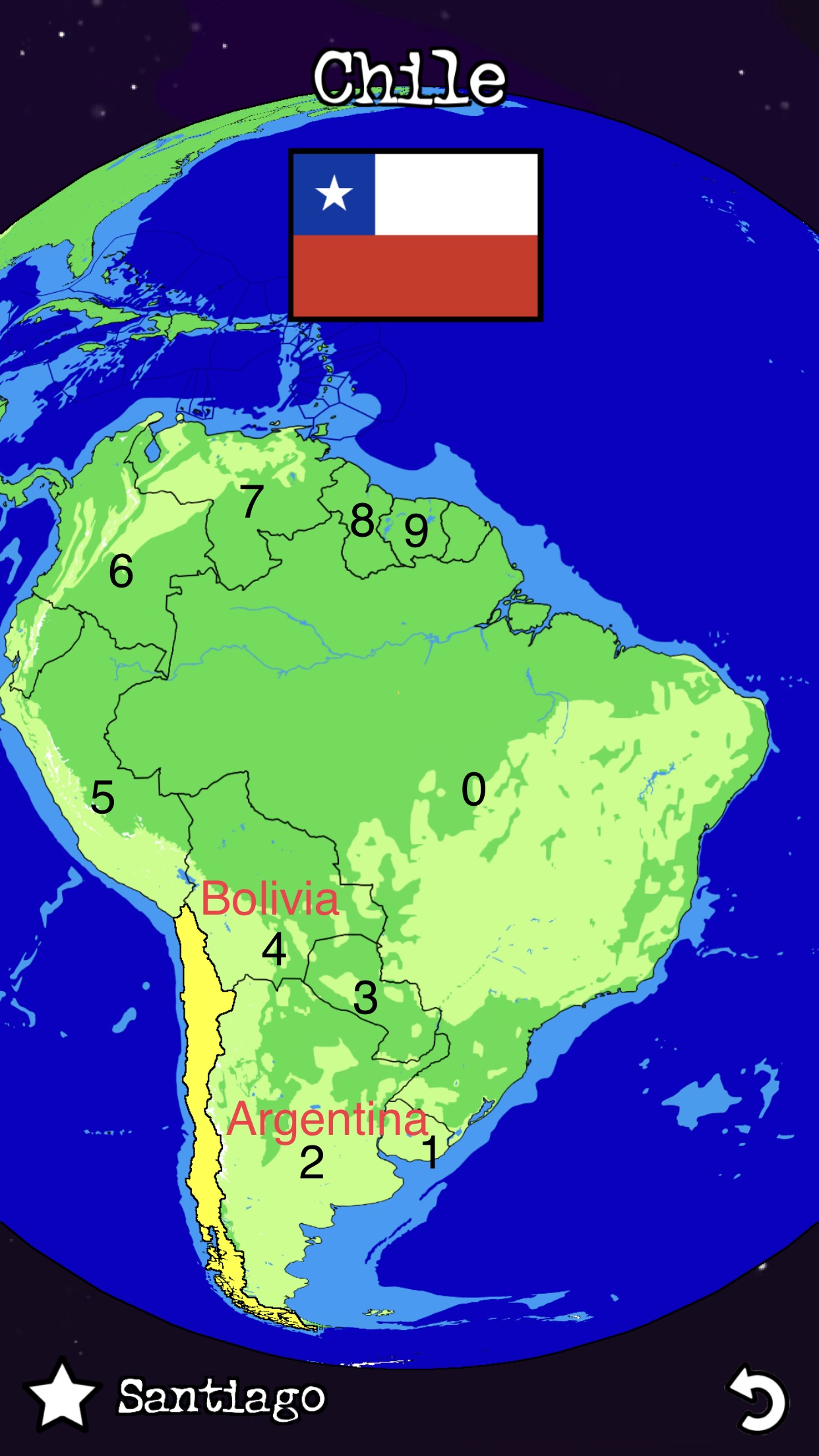
This is the fantastic image of South America (Snillsprov is good in making images, drawings)
I personally liked, Snillsprov sketching, drawings so much…
@Rajadodve786@Epix101, thanks for your replies.
For the shape, I would like to use Raja suggestion, and the picture is creative.
For the position, I have my encryption and probably I will stick with my original plan.
Algo
In a MP, do:
Locate the biggest country (BC) on a map, name peg 0
From BC, Start from clockwise search the surrounding countries, name peg x:1, 2, 3, …, 9
The outer loop countries, find two biggest surrounding countries from x, and name the country with 10x+y e.g. 21, 41 means the same name Chile, and thus we know 12 Argentina and 14 Chile means the biggest two surrounding coutry and easier to locate Chile.
If the map is too big, i.e. Asian: Divide the map into smaller pieces, such as 4 sectors: China group, Indonesia Iran and Saudi Arabia. Then do steps 1-3.
South America
0 Brazil
1 Uruguay
2 Argentina 21 Chile
3 Paraguay
4 Bolivia 41 Chile
5 Peru 51 Ecuador
6 Colombia 61 Ecuador
7 Venezuela
8 Guyana
9 Suriname
10 French Guiana
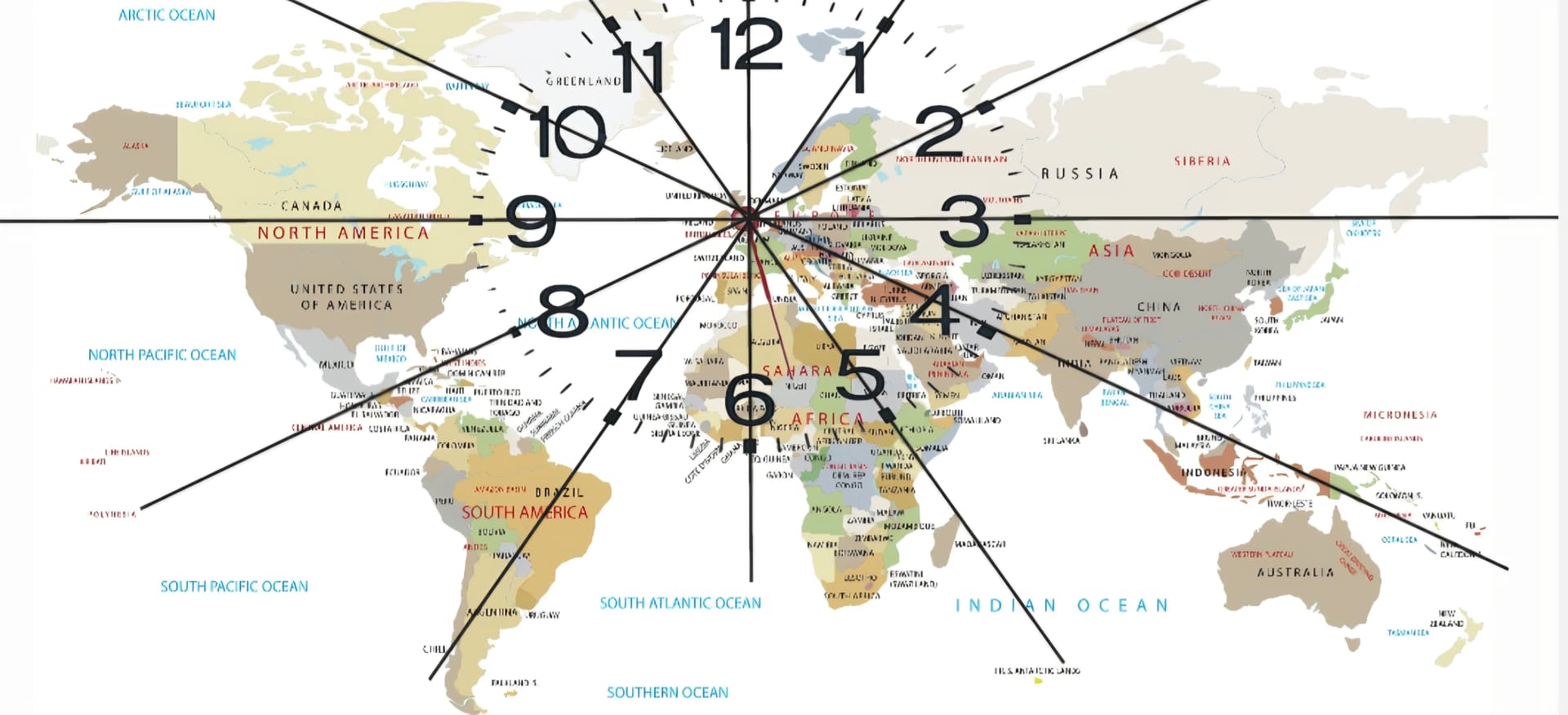
I’m trying to overlay a translucent clock onto the map so I can simply assign a time to the countries… Follow the line of the hour line and there it is.
It’s a new idea so I need to refine… Possibly adding some sort of distance along the line to tell me exactly where the place is.
I have the centre of the clock as my location in the UK.
So France might be 6…
I haven’t heard of anybody else using this approach, is it new?