I did the same 2-3 years ago, but with at least one interesting fact instead of the currency (for example: “Tuvalu, the ending .tv from many websites comes from this country”).
I´m not sure if a memory palace is the right tool for this. You don´t need the countries in a specific order. I would recommend Anki, you can already find prepared decks on the internet (even with the location of your destination). The currency can be added on your own.
If you want to use a memory palace, you can sort the countries by size (that is something I did with the biggest 50).
It it similar to learning vocabulary. I can´t give you a lot of examples, because I didn´t learn it in English. But here is one: when I think of Madagaskar, I think of the 3 penguins from the movie. Antananarivo is the capital. So I divide it into ant, (b)anana, riv(er). So the penguins are hunting an ant, who is on a banana on a river.
You don´t need every letter or the exact order. Cuba is for me enough to think of Juba (maybe there is a big J on the flag?!). Or camp to think of Kampala.
I wanted to have a feeling for where countries are in the world; I started by treating the whole world like a memory palace and charting a route through it that would (roughly) let me visit all the countries without crossing my own path. This was a good start for my purposes, and I made an Anki card for each segment to cement them.
Since it’s a single continuous path, I was able to number them, with a number image for every tenth country (the 30th is a moose, 40th is a rose, etc.) This helps be be sure I’m not missing anything.
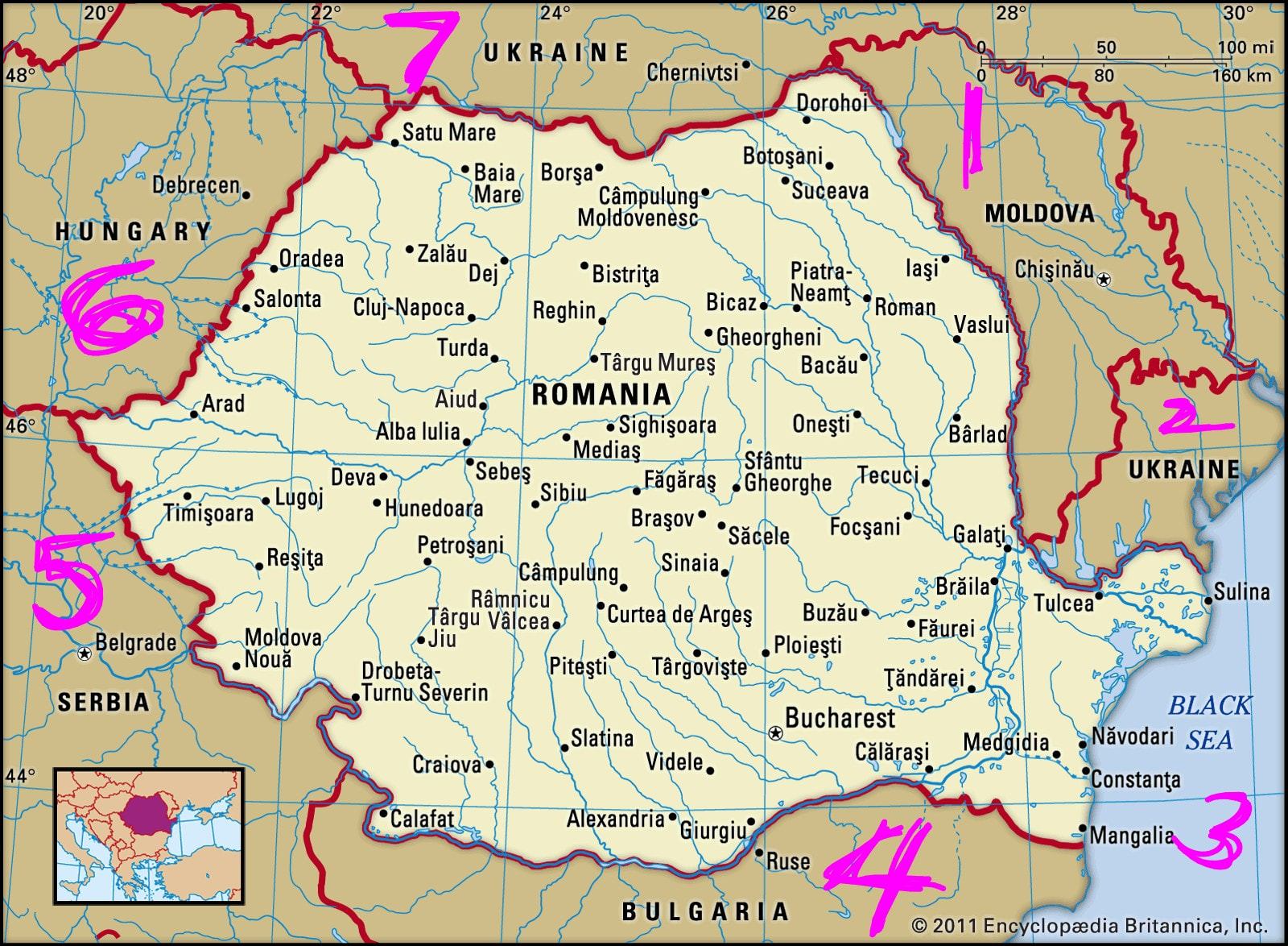
But I was still confused about what was next to what, so I started making cards for each country listing the borders (other countries, bodies of water, etc.) for each, starting in the Northeast like a clock. Romania, for instance, is bordered by Moldova, Ukraine, the Black Sea, Bulgaria, Serbia, Hungary, and Ukraine again. This gives me a better idea of what’s near what.
It sounds like this is a bit different from what you’re working towards, but it has really helped me visualize the map and remember all the countries.
I have named the states of my country after the object they resemble in shape.
For example, Maharashtra is a Godzilla.There is a state Telangana,which appears to be attached at Godzilla’s mouth,so I imagine it as fire spit by him.
If I try make some sort of grand picture with these logical relationships of objects interacting,you can actually just memorise all the surrounding states to a given state(or countries in your case)
The book “ How to build a Memory Palace Book One And Two: Memory Improvement Book Using Cutting Edge Memory Palace Techniques” by Sjur Midttun is available for £2.49 on Kindle UK and has quite extensive advice on these questions, including lists of all countries in a particular geographical order e.g. go from Morocco westwards to Egypt, then back eastwards in a band of countries to the East and then return west etc. See his webpage World Memory Palace as well. (My variation was to store the sequence in a 200 loci memory palace based on a large supermarket near where I live.)
I haven’t tried creating a comprehensive story since I do not need one.
In case I do—which will likely be the case when I start with Geography after completing medieval and modern history—I will let you know how it went!
You can try something similar yourself.
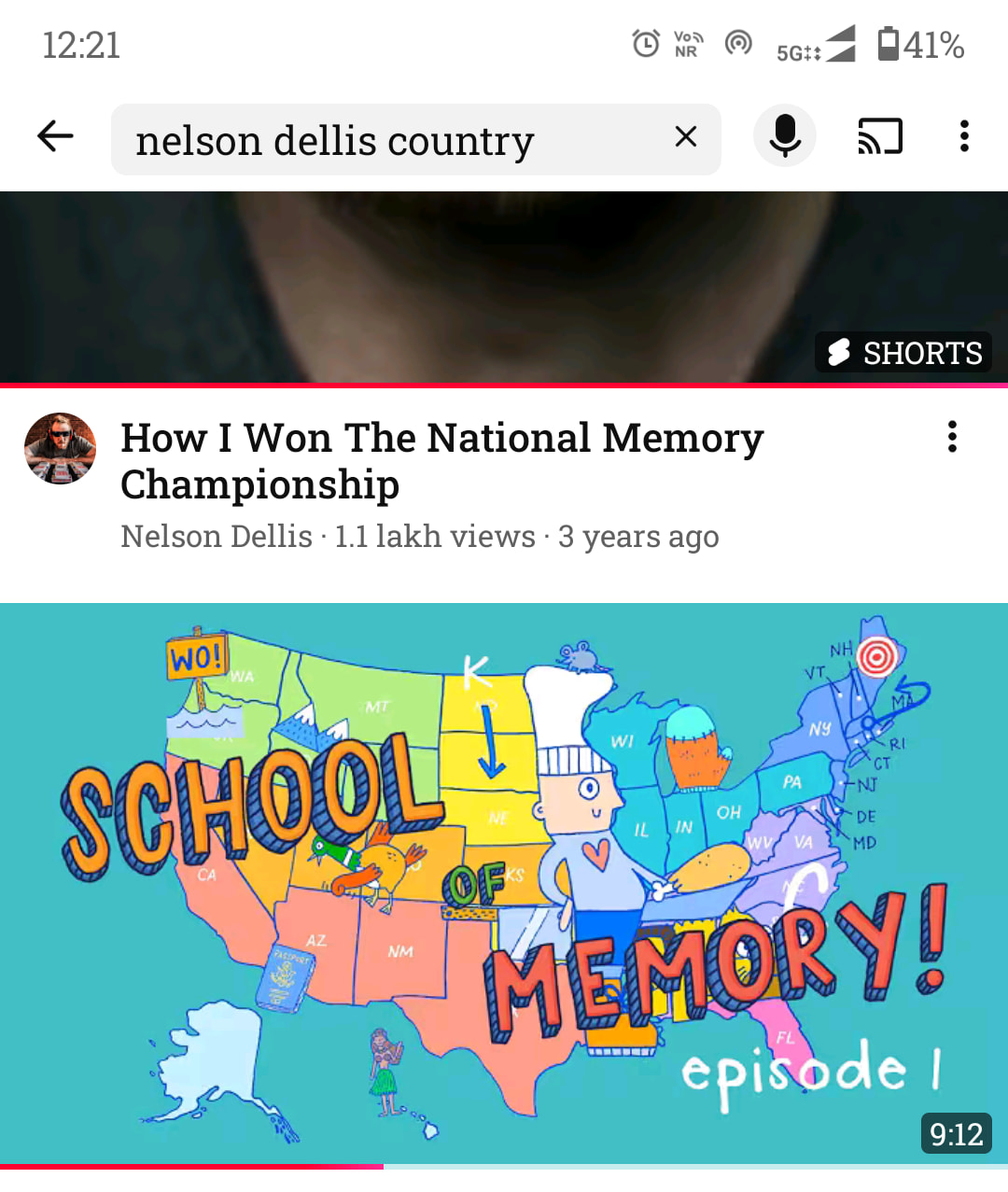
Take a look here,on this map in the thumbnail.
This isn’t EXACTLY how I would do it, but something similar.
You see that chef there? The chicken leg?
I will just do that to all the countries.
Ofcourse you should experiment on what works for you and what doens’t.All the best! The important part is to have fun and not be demotivated.It’s fine as long as you complete memorising them, irrespective of the method.
I would have done it myself to states,but I unfortunately lack the time for it due to studies.
I’ve learnt the countries over the holidays with the app Seterra.
In the learning mode, I looked at the map and chose a path going through all the countries (one continent at a time: Africa, Asia, etc.), adding mnemonics for countries that were hard.
Then friendly competition with others in test mode.
The map itself is already a memory palace.
Also, make these countries real! They should not stay abstract concepts, but become real places, with real people to you. Associate stories with the countries:
My grand parents once made a cruise on the Nile, so I imagine them starting on Lake Victoria in Uganda, going through South Sudan, Sudan, then Egypt to arrive in the Mediterranean Sea. (This isn’t true, they only were to Egypt, but for memorisation purposes, I’m looking at the whole Nile and imagining them there).
I have friends who lived in Rwanda and suffered a lot during the conflicts between Hutu and Tutsi so there already is a very emotional connection with Rwanda and Burundi, I won’t forget these countries.
I lived in Austria for a while so I learnt the neighbour countries. I have family in Germany so it also easy to pay attention to who their neighbours are.
If you don’t know people from these places IRL, find books, comics, movies that tell you stories of the people living there. It makes the countries become alive and memorisation easy.
After all we learn these things because we are curious about the world and the other people who live in it!
Well, I have a Pro tip to memorize them easily. You have to memorize them by geography not randomly. To make it more simple you can start with the continental then go regions wise and then memorize it.
Thanks
When I did it, I made the map itself the memory palace. Each country was its own location. It was less about having a sequence and more about spatial/holistic awareness.
I exploited chunking extensively: taking regions (e.g. north Africa) with a small number of countries and mastering the locations of countries relative to each other, instead of trying to swallow too much at one time. This approach helps you avoid confusing neighboring countries with each other, and also to understand relationships/context between countries in similar places.
I also memorized the shapes/outlines of countries. Sometimes, I took specific features and identified that with the country. For example, China was a giant chicken with two island legs (Taiwan and Hainan) and Brazil looked like a giant brain or broccoli (all start with B).
Knowing the geographic/demographic/political/cultural contexts of each country also helped distinguish each one. You can also make funny stories. For me, Austria looks like an unwell deflated stomach with wrinkles, which reminds me of when Austria lost massive chunks of territory after WWI.
Certain parts of the world will be easier than others; it depends on where you’re from. In the Western world, Europe, especially western Europe, tends to be easier because we keep hearing about those countries. Pacific islands and the Caribbean are notoriously difficult.
As for currencies and capitals, I think cultural context helps more than anything. For currencies, there are certain currencies that are widely used, such as the US dollar and the euro. Memorizing the countries associated with the most widely used currencies will be your best first step, followed by drilling down specific regions of the world the same way you did the country shapes. For capitals, certain names are similar to those of their countries, e.g. Mexico - Mexico City and Brazil - Brasilia. You can use history/etymology or sounds to help you. For Russia’s Moscow, you can imagine a cow made of moss standing on the steppe/icy plain/Russian bear.