i want train memory palaces, my initial idea was to memorize all the states and capitals of my country, the place where they are in the map, and the format of the area they occupy. my question is how i should do that?
My initial idea was to create loci equal to the number of states, them i put 3 objects in this loci, one for the name of the state,other for the name of the capital, and a last one for the name of the region that contains it in the map. them each day i train this info using anki.
Instead of creating locations for the states I would use a blank printout of the map and have that be your locations so a lot of the heavy lifting will be done for you and you’ll be more familiar with where they are on the map after studying. I would then use the link method to tie the state names and capitols together and use something distinct about the shape of the state to link the images together. For example teaching my kids US states we came up with a few memorable story/play on words links:
Augusta, Maine
We rode a horse to see Maine but “a gusta” wind blew the horse’s maine in our eyes and we didn’t see much.
Juneau Alaska
Juneau (do you know) the capital? No but I’ll-ask-er (I’ll ask her)
Nebraska, Lincoln
Pres Lincoln with brass knees.
Sometimes just using a stressed syllable is enough to get you to the target as long as you’re somewhat familiar with all the states and capitols. It’s hard to come up with a verbatim sound alike word. Like Oklahoma, Oklahoma City Id probably just picture an OK hand sign on a skyscraper to remember the city part of the capitol and that would be just as good as trying to match the rest of the word.
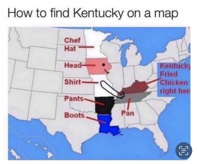
For Trenton, New Jersey we had a trench town full of trenches and people were wearing New sports Jerseys with the tags still on them. We used chatgpt to help make a toon image of that, sometimes that helps it stick. I also would consider looking for patterns in the state boundary lines there was a funny one I came across online and saved I will add it here.
If you draw pictures in the state outline you could link them with border states like Arizona, Phoenix. The Phoenix is flying up towards Carson City, Nevada which would be a dad and his son who is a car with arms and legs he is pointing at the phoenix.
You might also play around with just learning and using the abbreviations if it’s a hard one to make to an image. Like Sacramento, California we thought of eating a sacrament that was cauliflower but maybe CA SAC or SAC CA you have a crow trapped in a sack he’s saying Ca! Ca!
Yes, a blank map would be what I would do.
Then you can draw/write the mnemonics for each state on it and draw one path going through all of them.
An additional bonus is that the kinesthetic input (drawing things with your own hands) is going to help a lot for memorization.
Aside from using that to remember Kentucky with the fried chicken you could also have Tenesse be a tennis racket holding the chicken. The boots are Louisiana so that could be something, I can’t come up with anything at the moment, the pants Arkansas, Little Rock. Could be made up of Little rocks glued or knot together. The hat is Minnesota which could be a Minnie Mouse themed polka dot hat with a straw to represent soda. Of course you’d still have to link the capitol and state together but having one of them tied to the picture would get you the last piece.